Council has a strong commitment to the protection and enhancement of our precious coast and river systems.
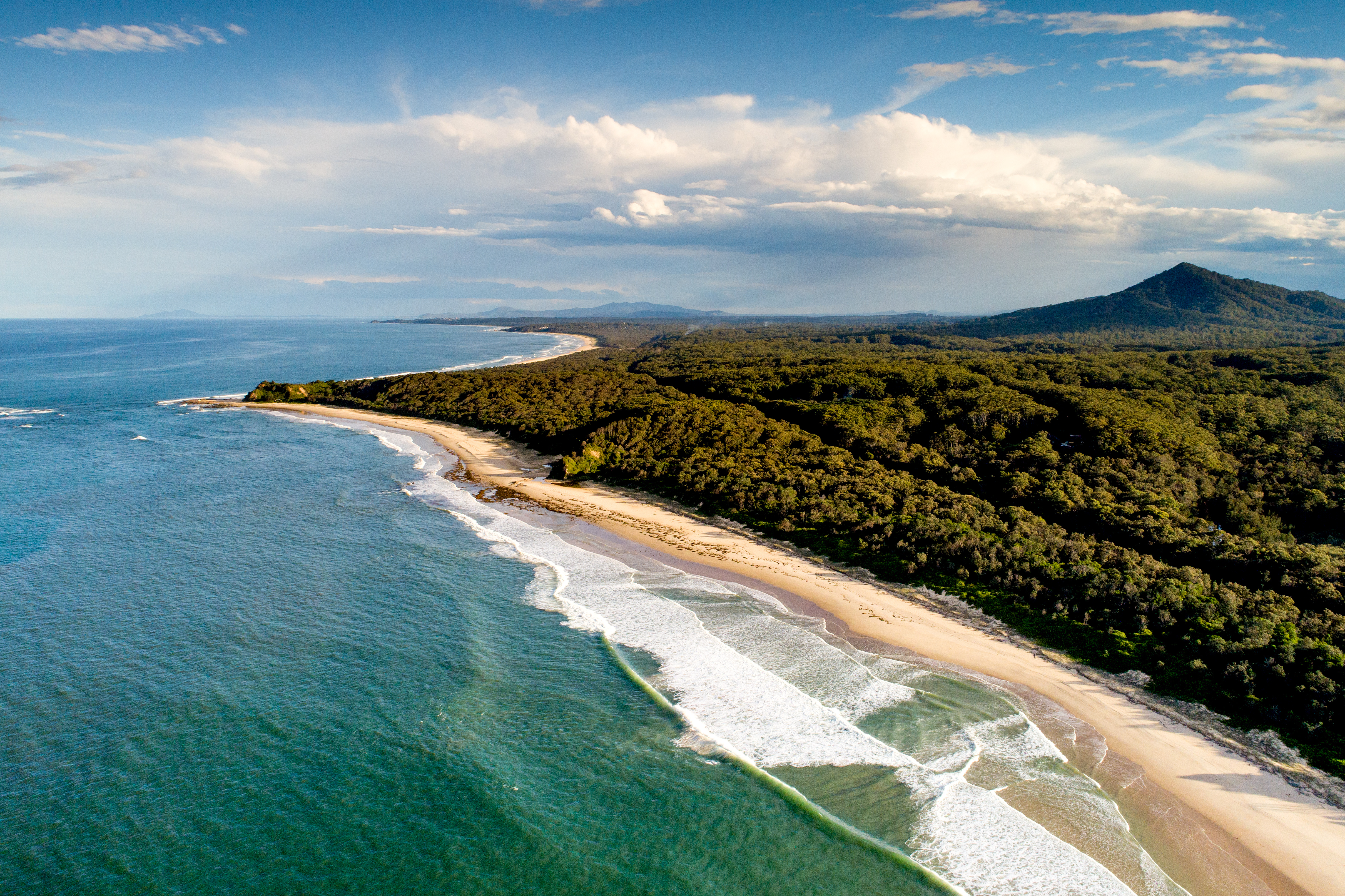
The Bellingen Local Government Area (LGA) coastline extends approximately 10kms from Oyster Creek in the south to Tuckers Rocks in the north, including the northern end of North Valla Beach, Hungry Head Beach, North Hungry Head Beach and North Beach.
It is one of the least developed coastal areas on the NSW north coast. Much of the foreshore is retained in public ownership, protecting an area of unique natural values that may also provide greater resilience to existing coastal processes and the impacts of future sea level rise.
The Bellingen Shire foreshores are much loved by people both across the region and further afield, who are drawn by it’s beauty and tranquillity. Commonly known as where the ‘rivers meet the sea’, it is the place where coastal, valley and mountain communities come together.
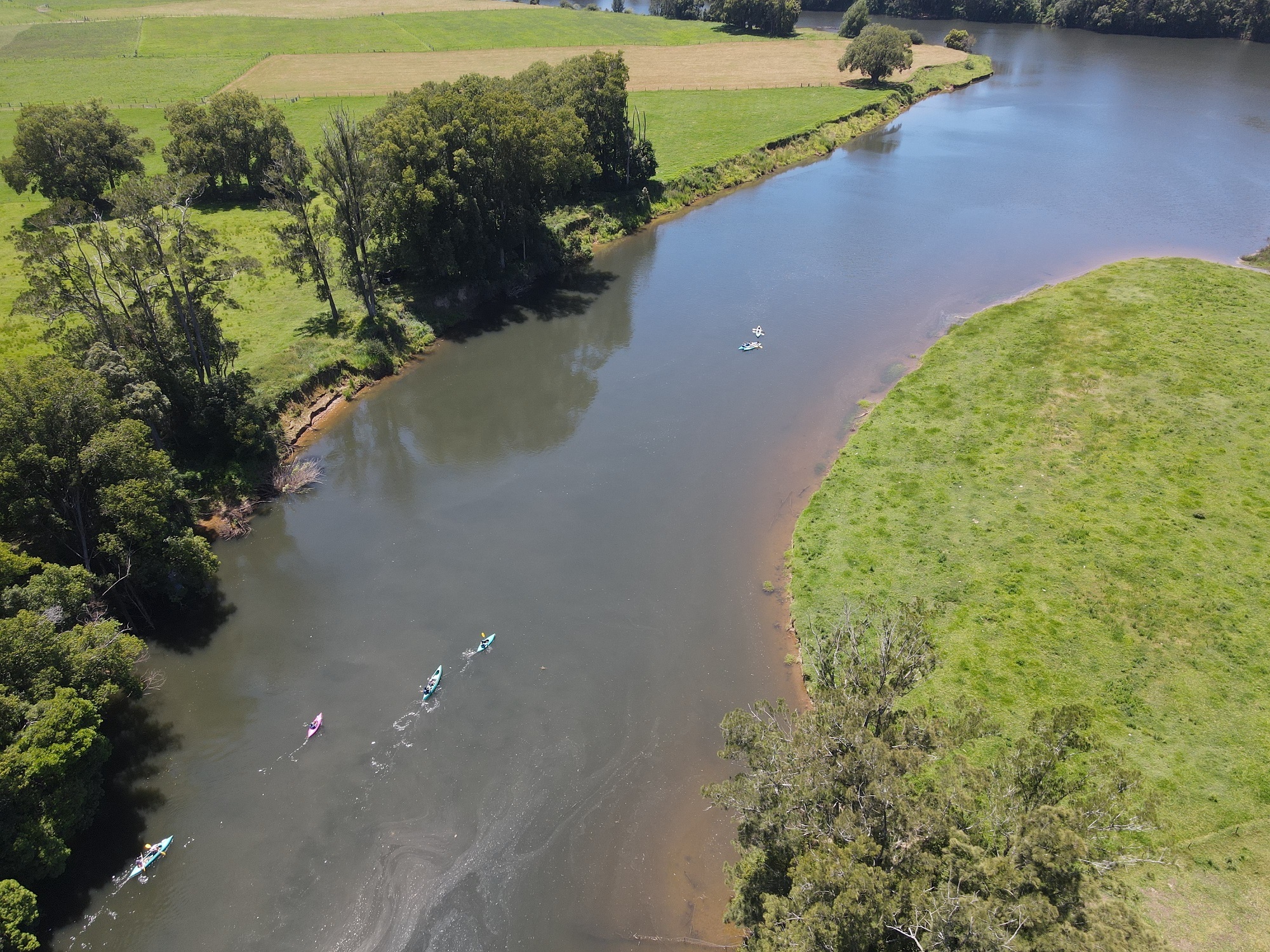
Two major river systems, the Kalang and the Bellinger, jointly enter the Pacific Ocean at the township of Urunga between North Hungary Head Beach and North Beach. The plateau contains the headwaters of the Nymboida and Clarence rivers.
2022 Floods - Riverbank Erosion Support
Local Land Services is working with rural landholders to understand riverbank erosion issues resulting from the recent flooding events.
Click HERE(PDF, 666KB) for more information.
Council and North Coast Local Land Services prioritised 20 reported flood damage properties in the Shire using a comprehensive technical tool. River structure, processes and behaviour for each site as well as social considerations and impact on vegetation and aquatic ecosystems were considered. The following projects totalling in $200k value have been funded:
- Riverbank restoration to preserve a Lowland Rainforest patch on the Kalang river.
- Vegetation Management on the Bellinger River at the Bellingen Golf Course to protect the integrity of previous river restoration structural work.
- Vegetation management and restoration of Swamp Oak Forest and Freshwater Wetland Threatened Ecological Communities on Mylestom Drive, Raleigh.
- Re-assessment of previous river reach plan on private property in Kalang estuary and implementation of revised plan to address riverbank slumping.
- Geomorphological assessment and erosion mediation plan for 5 sites on private property
Site 1: 375 metres of the Kalang river to protect agricultural farmland.
Site 2: 275 metres of the Kalang river to protect agricultural farmland.
Site 3: 50 metres of the Bellinger river to protect Houses and Canoe business.
Site 4: 120m of the Bellinger river to protect agricultural farmland.
Site 5: three sections of the Kalang river on one property totalling 100m to protect agricultural farmland
Coastal Zone Management Plan
This plan was adopted in 2014 and will be superseded by the Coastal Management Program at the end of 2022 (see below). Council is still working towards completing actions in this plan including:
Dalhousie Creek
Dalhousie Creek is located immediately south of Hungry Head. The creek, sometimes referred to as Hungry Head Lagoon, is classified as an Intermittently Closed and Open Lake or Lagoon (ICOLL) and has its entrance to the ocean at Hungry Head Beach.
The area is a highly dynamic coastal environment, which is subject to a large range of influences including the effects of climate change and sea level rise. The position of the Dalhousie Creek entrance as well as water levels within the creek are critical in determining the accessibility, amenity and public safety of this section of beach. Until 1997, artificial entrance opening was undertaken annually for the purpose of controlling the entrance location. Since 1997, the creek usually remains closed, but still opens naturally once or twice a year in response to rainfall, beach state and ocean conditions.
Several projects have been funded from the NSW Government to implement the actions identified in the Coastal Zone Management Plan.
- Dalhousie Creek Entrance Management Strategy
- Vegetation Management Plan
- Signage about ICOLS
- Coast Snap
- Beach berm realignment works
Council has installed a Coast Snap point on the headland at Hungry Head to monitor the entrance of Dalhousie Creek. Next time you visit, use your smartphone to measure beach change and help us understand and manage our dynamic coast.
Check out the images from Hungry Head in Urunga below and get more information about how you can get involved HERE.
Dalhousie Creek Entrance Management Strategy Part 1(PDF, 13MB)
Dalhousie Creek Entrance Management Strategy Part 2(PDF, 6MB)
Dalhousie Creek Vegetation management plan(PDF, 4MB)
Council is preparing the Bellingen Coastal Management Program (CMP), a long term plan to manage our coastal catchments with the help of a grant from the Coastal and Estuaries Grants Program. Council has elected to prepare one CMP for our shire incorporating the whole of our open coast.
Development of the CMP presents an opportunity to address key issues and prioritise management actions over the next 10 years. The Coastal Management Act 2016 (and other relevant legislation) establishes a specific role for local councils to prepare a CMP in accordance with the coastal management manual and in consultation with their communities and relevant public authorities
There are five stages in the CMP process.
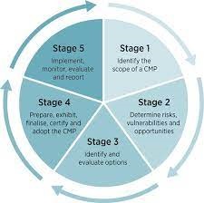
Stage 1
This was completed in 2020. It included preparing a Scoping Study in consultation with the community and other stakeholders that identified seven main issues or topics of concern.
Bellingen CMP Stage 1 Scoping Study Report(PDF, 20MB)
Stage 2
Stage 2 began in November 2021 and finished in May 2022. In consultation with the community and other stakeholders, we identified risks, vulnerabilities and opportunities within the estuaries and catchment of the Bellinger and Kalang Rivers and the open coastline.
Key issues that came out of this consultation were riverbank erosion, on-water speed limits not being enforced, the impact of visitors, campers and off-leash dogs, litter, vegetation loss and management, noise and amenity of powered boats and jet skis and dune destabilisation.
There were also many ideas for how some of these issues could be addressed. These included improved control of noxious weeds, engaging with traditional owners, more active regulation and monitoring, eco-friendly linked pathways and bike trails, permits for 4WD beach access and replacing and maintaining signs.
You can view the interactive map here.
The issues raised were then workshopped with key stakeholders to determine their level of risk, the consequences of doing nothing and possible mitigations. This allowed the project team to highlight key risks to be addressed via management actions. The stage 2 summary report is available in the link below.
The Water Quality Management Plan was recommended to be completed as part of stage 2 to address gaps in the knowledge and management of water quality within the Bellinger and Kalang river catchments. The plan is now in the final stages of drafting and will be released to the public once completed.
Stage 2 Consultation Summary(PDF, 2MB)
Stage 2 Summary Report(PDF, 13MB)
Stage 3
Stage 3 commenced in July 2022 and will involved workshopping the draft management actions with impacted stakeholders and the broader community. The feedback from these workshops was then sent to all stakeholders responsible for implementation for "in principle" support. The focus of this stage is on refining management actions for extreme and high-risk hazards and issues, all the draft management actions will be subject to review ahead of the draft CMP going on public exhibition in Stage 4.
Stage 4
Council is currently preparing the final exhibition draft to go on public exhibition.
Water Quality Management Plan
Council recently completed a Water Quality Management Plan as a part of stage 2 of the Coastal Management Program. The aim was to identify water quality issues and management solutions in the Bellinger and Kalang Catchments. The plans recommendations have been submitted to the Draft CMP.
Water-Quality-Management-Plan-Final.pdf(PDF, 14MB)
Bellingen River Watch
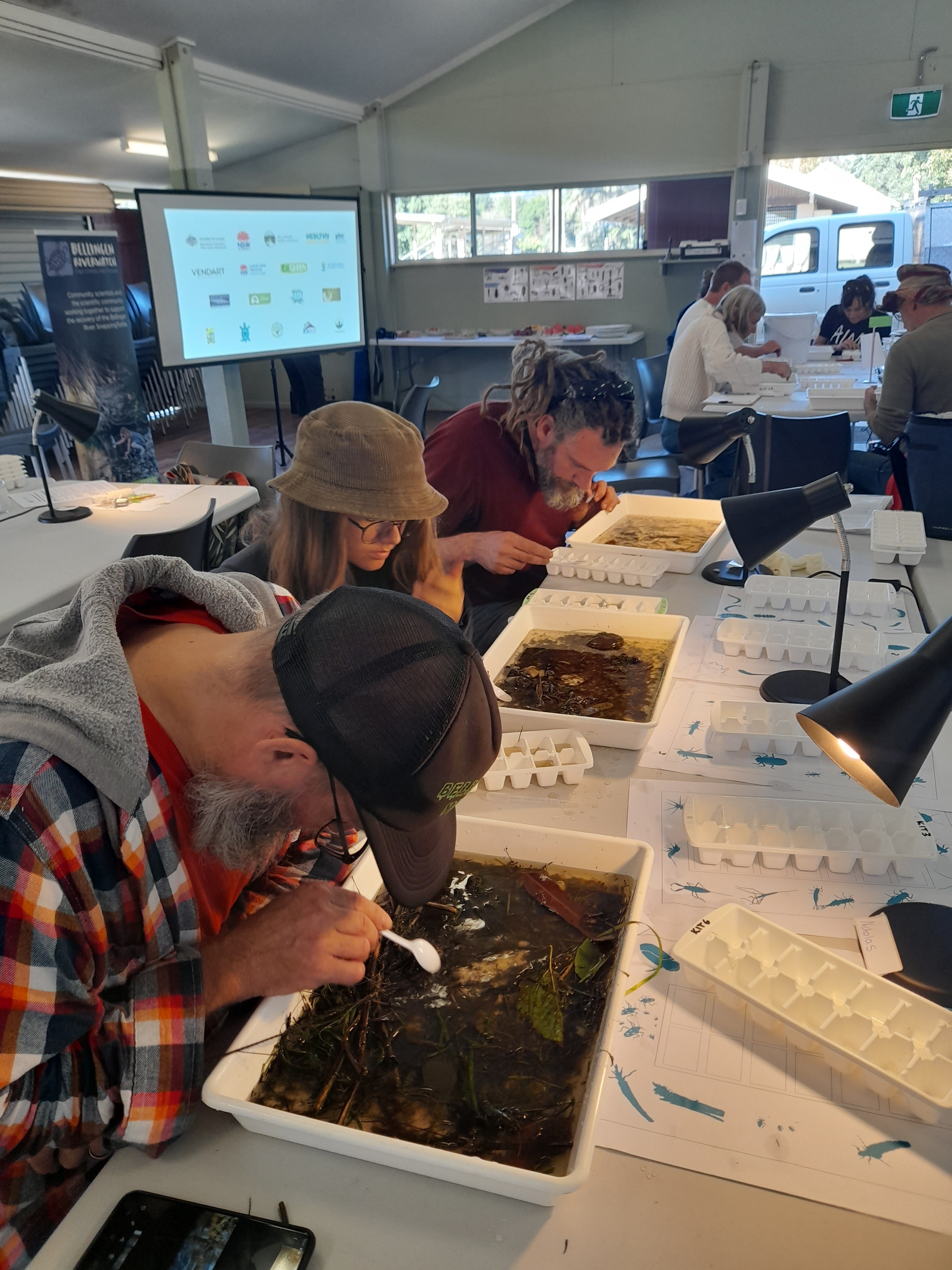
Council is a program partner to Bellingen River Watch, a citizen science program managed by Oz Green. We provide the program with operatinal funds from our Environment Levy as well as In Kind technical water quality support. Bellingen Riverwatch was created to provide consistent water quality data in the Bellinger and Kalang catchments following a disease outbreak that caused a mass death event of the Critically Endangered Bellinger River Snapping Turtle (BRST) in early 2015. The program assists the volunteers and schools to test water quality each month and survey for maco-invertebrates twice a year by funding testing equipment and providing ongoing professional guidance to the team.
Bellingen Riverwatch Data Portal
Bellingen Riverwatch 5 year Data Report
Bellingen Riverwatch: Can Citizen Science inform Science? Video Conference presentation DPIE Science.
Beach Watch
Council monitors water quality weekly at seven popular swimming sites in the Shire as a part of the Beach Watch program between October and April. The results are available here.

Flood Recovery Program for Water Quality Monitoring
The Bellinger and Kalang rivers are a part of the NSW EPA's Flood recovery program for water quality monitoring. Council has a voice on the North Coast Stakeholder group for the project. It aims to develop and share information about flood impacts on water quality and waterway recovery so that land managers can make better decisions.
The program samples 11 sites in the Bellinger and Kalang rivers during flooding, post flooding and in normal flows. It tests for Water Clarity (Turbidity), Algae (Chlorophyll a), Total Nitrogen, Total phosphorous and Bacteria (Enterococci and E.coli).
Bellingen LGA Water Quality Grade Map
The program has also installed one real time data logger in the Bellinger River at Repton which collects data on Temperature, Conductivity & Salinity, pH, Dissolved Oxygen, Turbidity, and Chlorophyll.
Repton - Bellinger River - real time water quality data
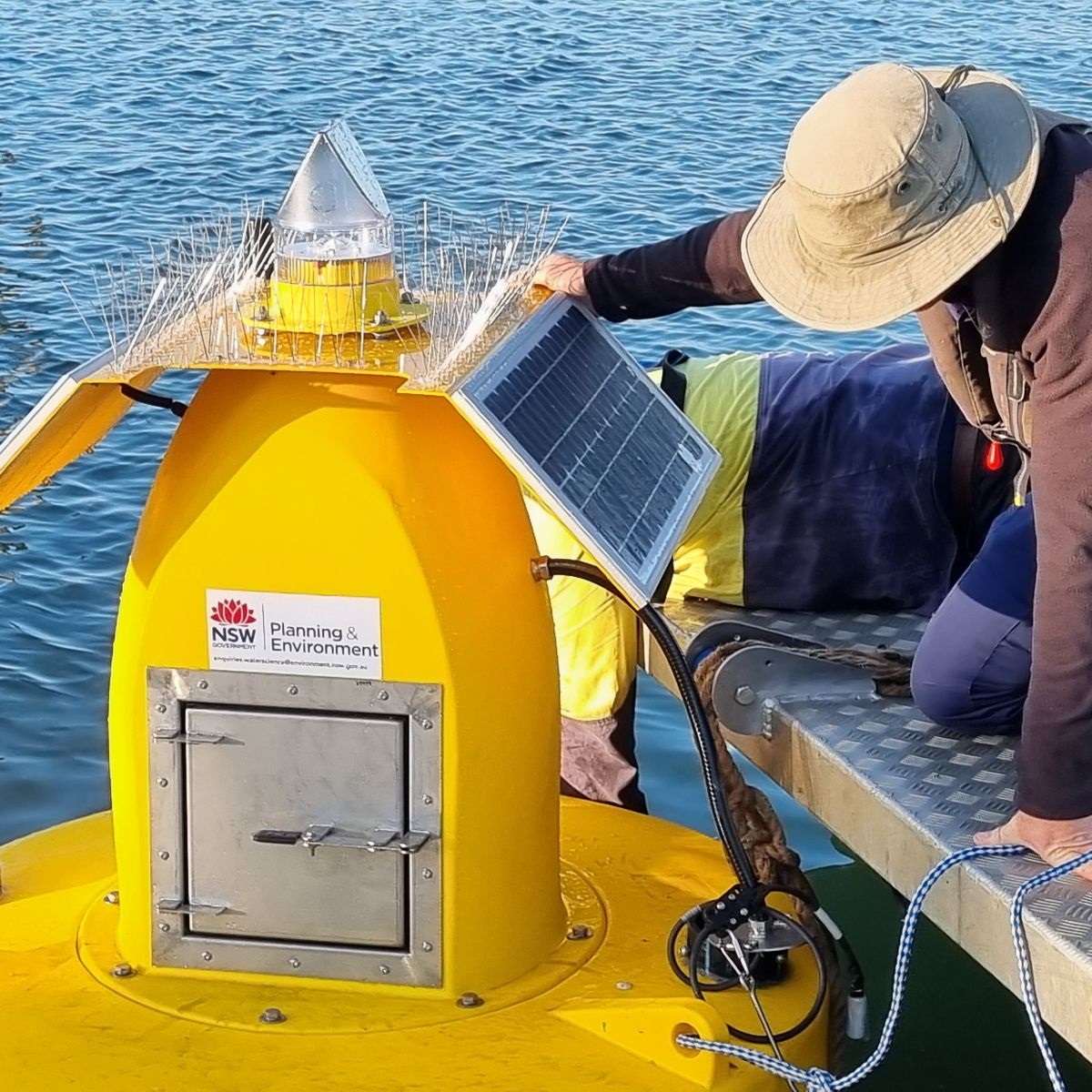
Setting up a smart Buoy real time data logger in the Clarence River at Iluka (DPE)
Ongoing Water Quality Collection
Council also monitors water quality on a regular basis as a part of their EPA licence requirement for our waste water treatment plants. The results are available on Council's water portal.
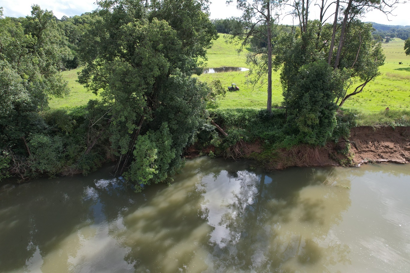
By addressing problems such as weed invasion, lack of native tree cover, erosion and sedimentation, these projects enable Council to work with the community to ensure healthy rivers are maintained and improved now and for our future. Council’s river rehabilitation projects are funded through external grants, often with matching contributions from Council’s Environment Levy and/or private landholders. Selection of project sites and activities depends on a range of factors including:
- grant priorities and eligible activities
- landholder interest, capacity to provide matching contributions (cash and/or in-kind) and commitment to follow-up maintenance
- strategic priorities (often guided by management plans, studies and/or condition assessments).
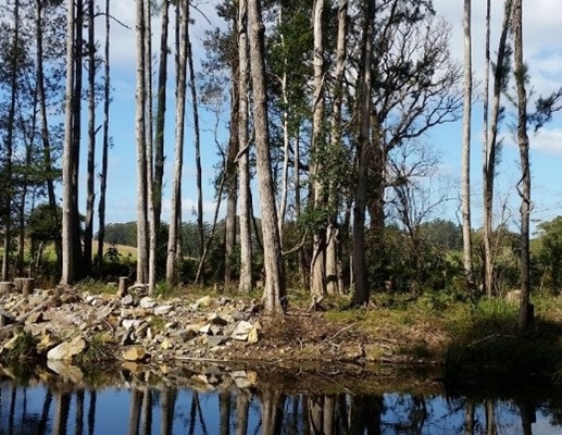
Restoring Reserves of the Never Never
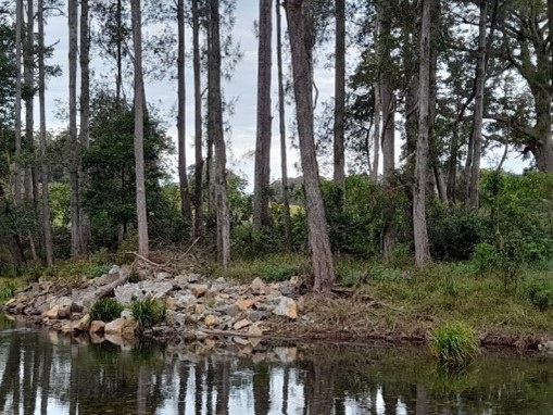
This project was a NSW Environmental Trust funded project partnership with the Never Never Catchment Group and is was completed in December 2021. Bellingen Shire Council and Never Never Catchment Group are working in partnership to protect and enhance the riparian zone within Earl Preston Reserve adjacent to the Never Never River and Timboon Road, Gleniffer. The vegetation includes an Endangered Ecological Community, which is threatened by invasive plants and compaction from stock and vehicle access. Rock Groynes were placed in the river to manage erosion and mature weed trees were removed and mulched, juvenile weeds are being managed and the width of the riparian zone will be increased by revegetation and fencing. This will improve the stability of the eroding river bank and complement rehabilitation on the opposite river bank. Stock and vehicle access will be controlled by fencing plantings. Community working bees have provided enrichment planting and interpretive signs provide an opportunity to involve the local community and to raise awareness of local environmental assets, riparian rehabilitation techniques and priorities in Council's Gleniffer Reserves Master Plan.
2017
2019
2021